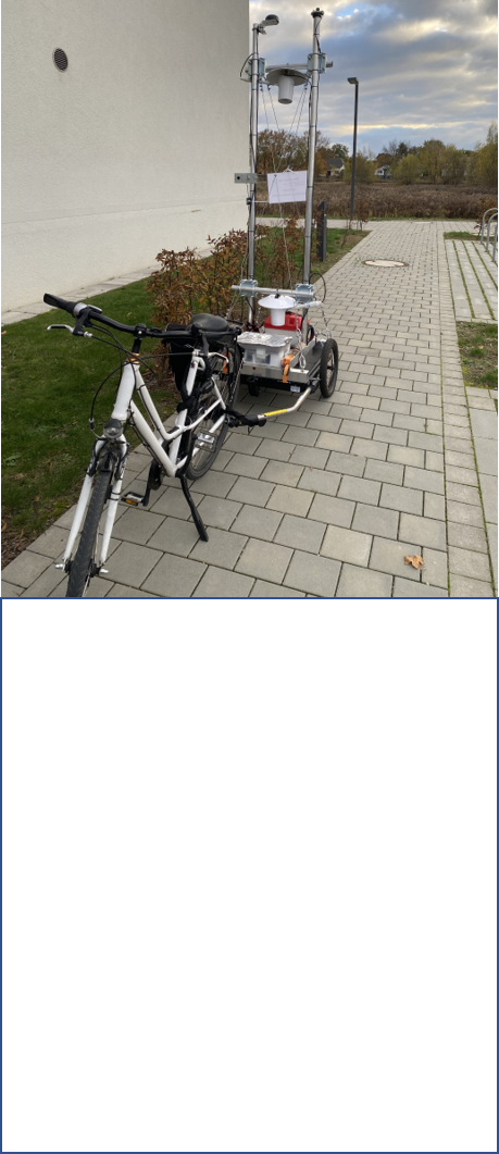
Mobile measuring station for air hygiene and meteorology
The mobile measurement unit for air hygiene and meteorology is towed behind a bicycle and measures parameters such as aerosols in the size fractions smaller than 10 µm and smaller than 2.5 µm. It also records air temperature and relative humidity at different heights, as well as radiation. This measurement unit is used to analyze air pollution and the urban heat island effect in cities.
Aquatic Sensor Systems
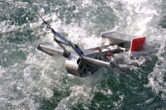
The department has a variety of sensor systems for in-situ and online measurement of biochemical and physical parameters in water bodies. The Biofish (see image), which is towed behind a boat, allows for the three-dimensional mapping of water parameters such as pH, turbidity, temperature, yellow substances, chlorophyll a, electrical conductivity, photosynthetically active radiation, and oxygen content. The Biolift is used to continuously record depth profiles of these parameters at a fixed location. Additionally, it is connected to a meteorological weather station. The department's various flow vector sensors enable the measurement of turbidity throughout the water column as well as the recording of flow vectors. Additionally, several multiparameter probes are available for in-situ analysis of biochemical and physical parameters, including: A Benthotorch for analyzing algae growth on solid surfaces, an Algaetorch for measuring algae concentrations in water, and a Xylem multiparameter probe. For water sampling, a free-flow sampler is available, while sediment samples can be collected using a grabber or a Mondsee corer. Currently, these systems are being used, for example, at the Wahnbach Reservoir near Siegburg and Caputher See near Potsdam.
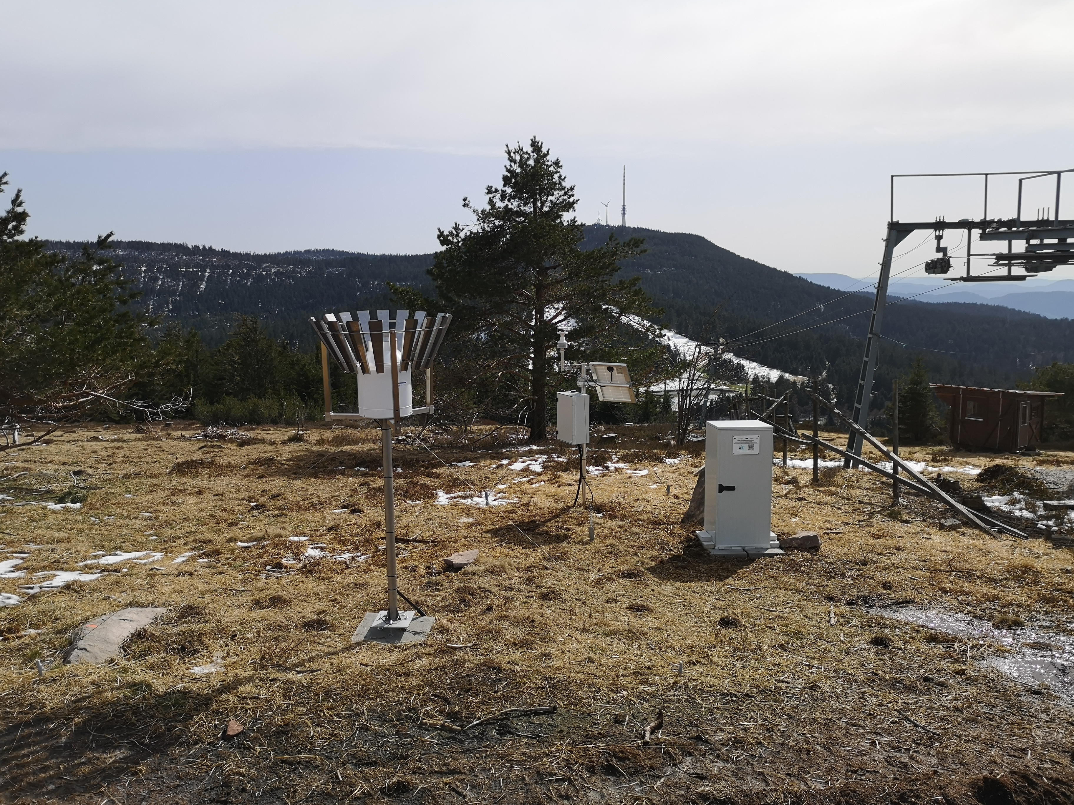
Meteorological Measurement Network Bühl
As part of the BMBF-funded project BioWaWi (Biodiversity and Water Management), a meteorological measurement network with currently nine measuring stations, which also measure soil moisture down to a depth of one meter, was established in the Bühl area, south of Karlsruhe. As part of the recently approved BioWaWi-KI project, this measurement network will be expanded by an additional five meteorological stations. The aim is to analyze the small-scale variability of precipitation and soil moisture in the water protection areas of Stadtwerke Bühl and to derive their influence on biodiversity development. The goal is to develop action options to preserve biodiversity and soil quality despite increasingly prolonged dry periods.
Land subsidence observatory in Ca Mau, South Vietnam
A 164 m deep borehole was drilled at the CA Mau pilot site in the southern Mekong Delta and a measuring chain with eight digital extensometers was installed for depth-differentiated measurement of land subsidence. The measuring chain hangs freely in a measuring tube, which is divided into separately movable sections by telescope segments. Magnetic rings are attached to this measuring tube at various depths. The slightest movements in the subsurface as a result of the sediment interaction are transferred to the movable measuring tube sections and their magnetic rings. The relative movement between the extensometers and the magnetic rings is digitally recorded at 10-minute intervals and thus allows a high-resolution (< 0.1 mm), depth-differentiated measurement of the sediment compaction. A radar reflectometer is also installed, which is used to measure land subsidence using satellite technology.
In addition, groundwater levels and salinity of the aquifers at 90 m, 150 m and 240 m are measured hourly at this pilot site. A weather station and a soil moisture profile probe are also installed. This makes it possible to investigate the relationships between the observed land subsidence and the groundwater and soil water dynamics.
Groundwater levels and salinity are also measured at 150 m and 240 m at another location around 10 km away.
The land subsidence observatory is operated together with the KIT Institutes for Geochemistry and Mineral Resources and for Photogrammetry and Remote Sensing as well as the National Center for Water Resources Planning and Investigation, Vietnam.

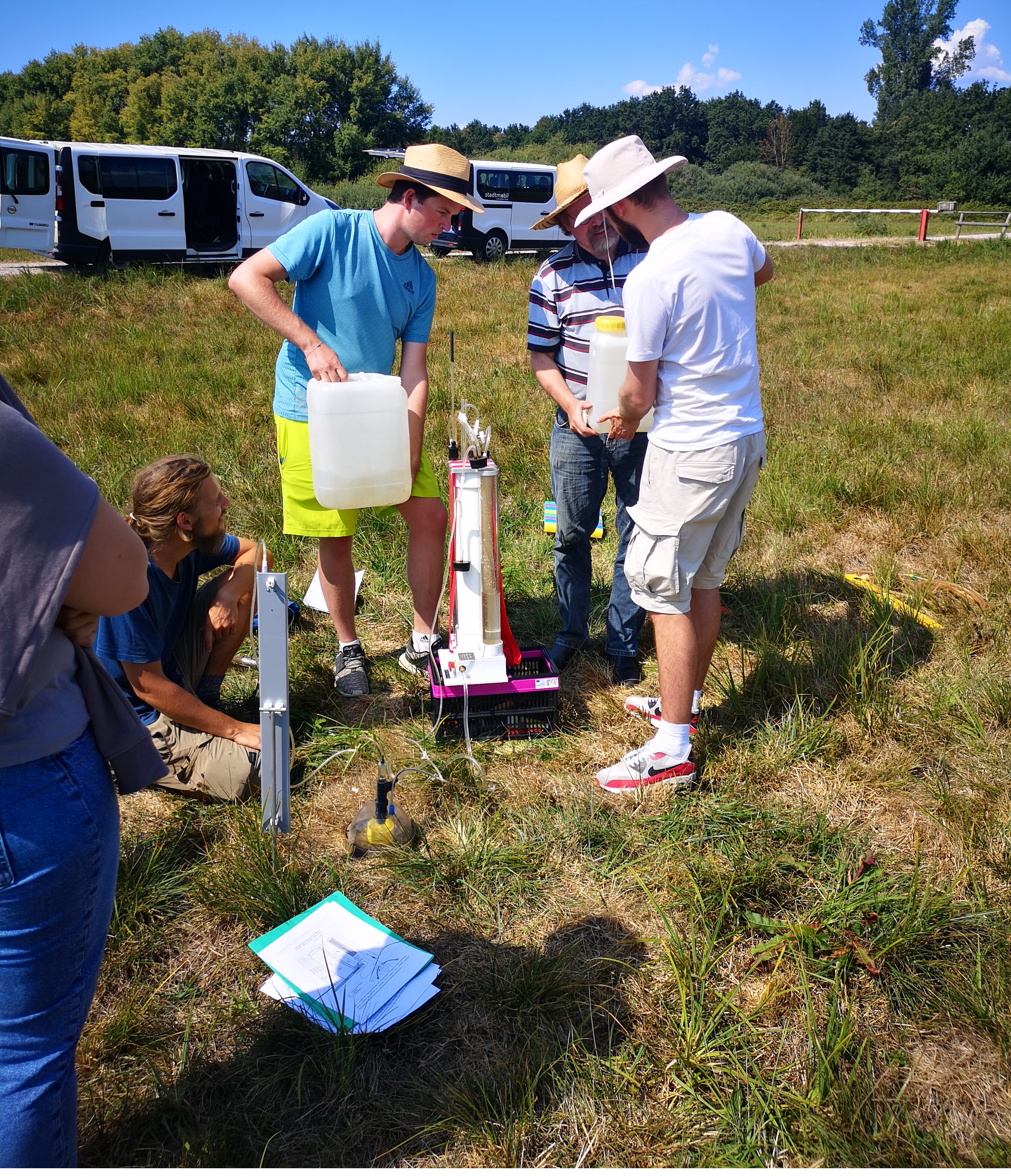
Field laboratory for the determination of soil water balance parameters
The department has various instruments for determining the infiltration and conductivity of water in soils:
- Infiltrometer: UGT Müncheberg hood infiltrometer
- Infiltrometer: Terra System tension disk infiltrometer
- Infiltrometer: Eijkelkamp double ring infiltrometer
- Permeameter/Amoozemeter: KSat Inc. Compact Constant Head Permeameter
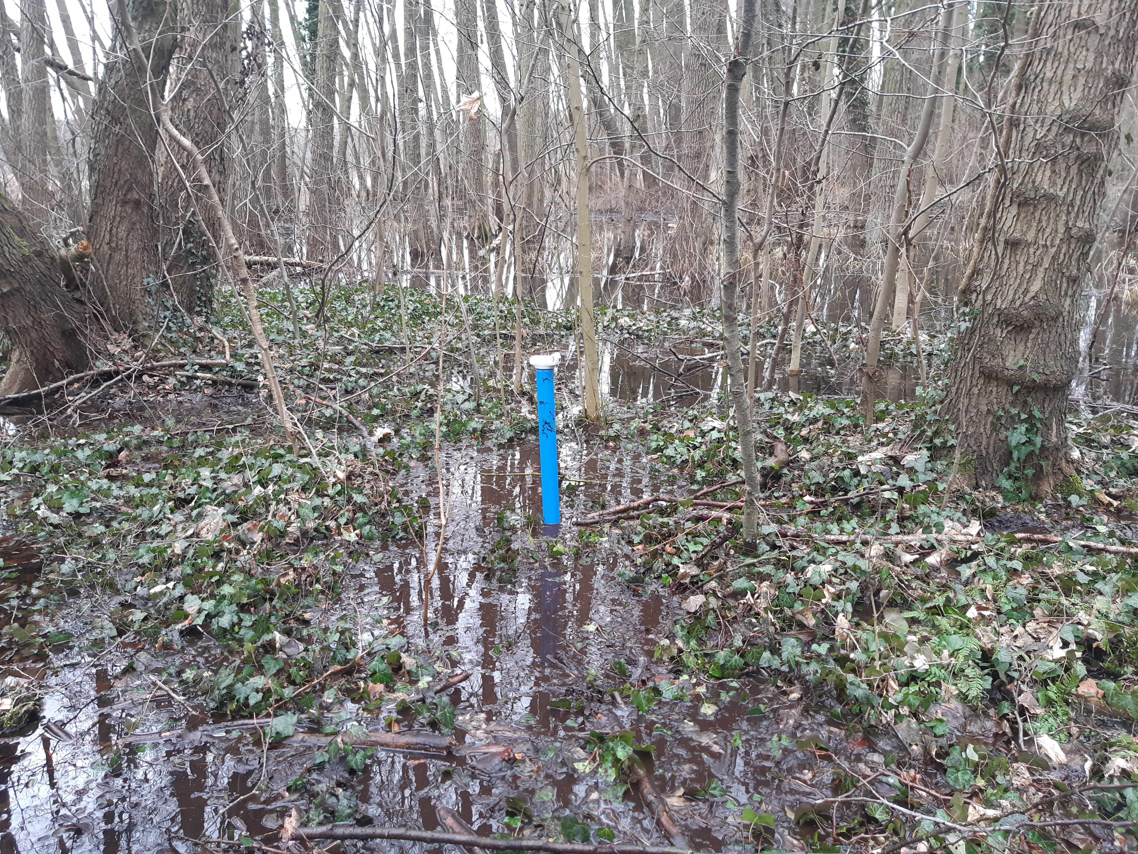
Bog gauge network in Caputh, Germany
The department is monitoring the development of water levels in a silting bog on Lake Caputher near Potsdam. With the water level monitoring, it supports the activities of the “Klimainitiative Schwielowsee e.V.”*, which has been testing damming measures on the lake's outflow since February 2024 in order to improve the water balance of the lake and bog by retaining winter precipitation. Some of the observation tubes, which are currently being monitored by water level sponsors with well whistles as part of Citizen Science, will also be equipped with water level probes in spring 2025. In addition to the water level network, a weather station will be set up in 2025 to provide data on precipitation and evaporation and thus make it possible to differentiate more precisely between the influence of weather and inflowing groundwater.
Background: In recent years, the water level in Lake Caputher near Potsdam has been too low, particularly in the summer months. Pine afforestation in the water catchment area and climate change are promoting a decrease in groundwater inflow and an increase in summer evaporation with a direct effect on the lake level. This in turn determines the water level of the approx. 6-hectare silting bog to the southwest. The bog dries out in the summer months and releases CO2 as a result of peat mineralization. A high water level in the lake is essential to protect the bog and the climate. Level monitoring and meteorological monitoring serve to document the effect of the damming measure on the lake and bog water levels and to develop sustainable dam management.
*locally founded association