GIS-Ressourcen
Leitung
Dr. Gerold Zeilinger
Campus Golm
Haus 27, Raum 2.27
Karl-Liebknecht-Str. 24-25
14476 Potsdam-Golm

Übersicht
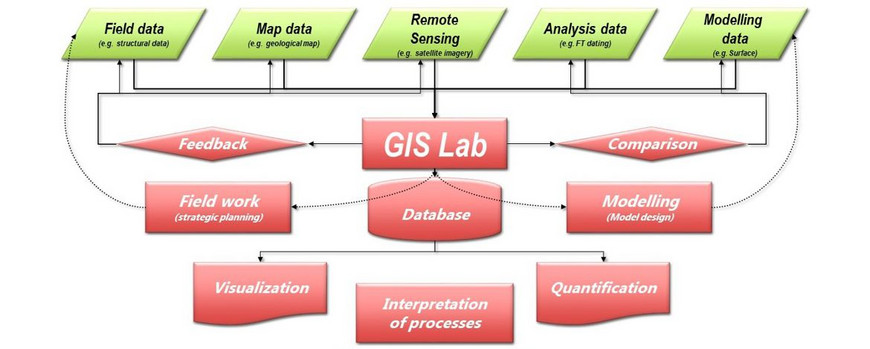
Die GIS-Ressourcen bestehen aus Hardware- und Softwareeinrichtungen, die für die Durchführung von Studien mit Geodaten unerlässlich sind.
Ein starker Fokus liegt auf:
- Sammeln
- Analysieren und
- Visualisierung von 3D-Geodaten.
Ausstattung
Die 3D-Datenerfassung erfolgt durch 3D-Felddatenvermessung mit:
- Terrestrischer Laserscanner (Riegl LMS-Z620)
- Nikon 300D Kamera (photogrammetrische Analyse, stereographische Fotos)
- Leica Viva GNSS (zwei Rover, eine Basis)
- 9 Panasonic FZ-G1 MK4 Tablets mit GNS 2000-Sensoren, Win 10, Field MOVE + ArcGIS
Für die Datenanalyse ist folgende Hard- und Software verfügbar:
- Drei 3D-Bearbeitungs-PCs, 3D-Visualisierung Planar 2010 M, + PC DELL Precision T5400 4 XEON CPU 2,5 GHz, 8 GB RAM, Festplatte 700 GB
- Software (ParaView, ArcGIS, AutoCad, Riegl Laser Scanner software, Kubit (Tachycad, Photoplan, PointCloud, hylasFM), MOVE (Informationen zur akademischen Lizenz), Fledermaus, Rivertools)
und für die Bereitstellung und Visualisierung von Daten:
- GIS Server (ArcGIS Server 10.3) mit 10 TB RAID System Dell PowerEdge T630, 32 GB RAM, 2x2,3 GHz, 10 Kerne, Windows Server 2012
- A0 Scanner Graphtec CS510 Pro + PC 4CPU 3GHz, 1GB RAM, Disk 70 GB, XP 32 bit
- 3D-Cave-Visualisierung und GIS-Computing
- Scape Pro 55 UHD 3M (4K/UHD Multitouch-Tisch)
Projekte
| GIS Server Projects (selected Projects using the Institutes Arc-GIS Server/Web Map Portal) |
| Multi-Touch-Tabletop und Smart Digitizing Device (TABGEO), sponsored by European Union and ILB |
| ALErT project: Growing and shrinking lakes on the Tibetan Plateau (K. Korzeniowska) |
| GeoDynALPS (The Alpine Geology from R. Bousquet et al., 2012) |
| Geologic and tectonic map Kohistan (J.-P. Burg/G. Zeilinger) |
| ASPNC Rio Grande Map (Study in Collaboration with GIZ and VRHR, Bolivia; G. Zeilinger, F. Kober and Team, Publication) |
| Landslide susceptibility (including data from Masterthesis A. Ponta & Bachelorthesis M. Liefeld) CBAGS |
| WB Movie "The Afghanistan resource Corridor" short (5 min) or long (10 min) Version (Map sequences done with GIS Server, in Collaboration with PROGRESS) |
| Geologic and tectonic map CBAGS, AGS |
