Since the gravestones were removed after 1945 and the area was cleared for sand mining, nothing today serves as a reminder of the former burial site. In order to enable a dignified commemoration of this place, it is now to be explored “non-destructively” – that is, without damaging the subsoil. To this end, Jens Tronicke, Professor of Applied Geophysics at the University of Potsdam, and his team are taking measurements on the site for a week. “We will probably see the boundaries of graves due to the different physical properties of the materials,” he says. “There is also a chance of finding evidence of the outer perimeter of the cemetery or former paths."
From the lecture hall to the field
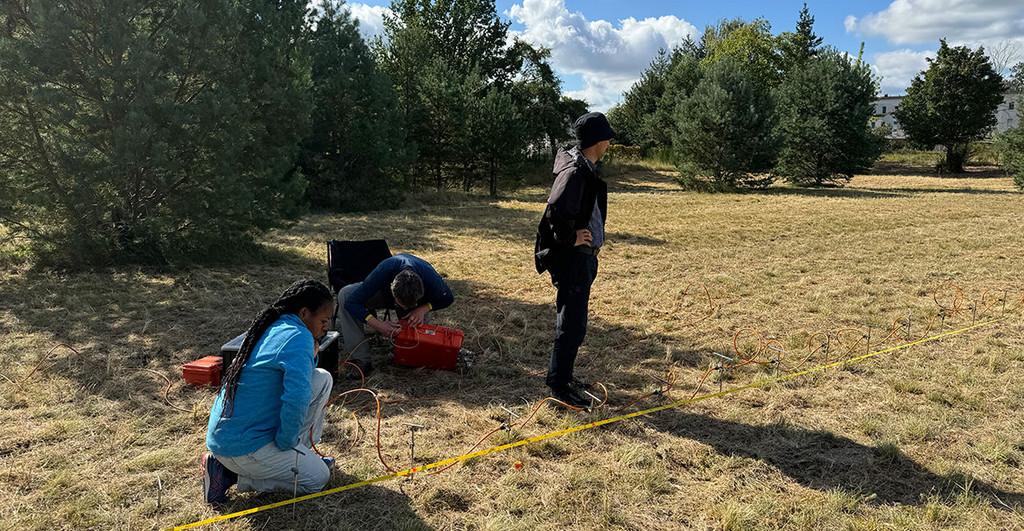
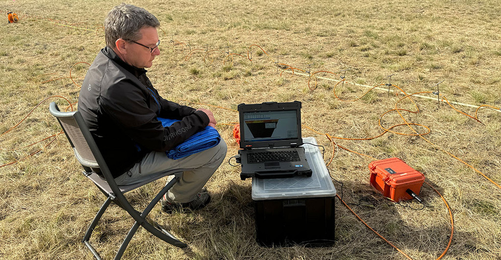
This morning, the three students Paulina Nitschke, Mercy Ekua Grimmon-Thompson, and Diyorbek Toshniyozov are setting up the electrodes for the direct current geoelectric sounding: The 100 metal rods are inserted into the ground in a line at 50-centimeter intervals and then connected to a cable. With this method, an electric current is fed into the ground via two electrodes, and the voltage generated is measured using two other electrodes. Both values determine the so-called apparent electrical resistance in the ground, depending on the distance between the electrodes. “Different arrangements of the feed and measuring electrodes are used, which have different sensitivities,” Prof. Tronicke says. “First, we use an arrangement in which all electrodes have the same distance.” The advantage of this method is a good signal-to-noise ratio. The connection test shows that some electrodes do not have good ground contact and do not provide any measurements. So the students have to correct their positions again. Then the measurement is started. A two-dimensional image of the measured values is gradually emerging on the field laptop, which later forms the basis for reconstructing a model of the subsurface. This works because the underground layers and materials have different resistances. The resistance is lower when there are conductive substances such as water, clay, or metals in the soil and higher when there are underground cavities, for example.
“Every morning, we discuss what we saw the day before and then think about where to measure next,” says Mercy Ekua Grimmon-Thompson. The students are enrolled in the English-language master's program in geosciences at the University of Potsdam and specialize in geophysics. “We have already become acquainted with geophysical methods in our courses,” says the student from Ghana. “The theoretical knowledge was repeated several times and also demonstrated in the laboratory. We are very well prepared to be able to apply the methods in practice.” Postdoc Philipp Koyan supports the field internship and says, “The field exercise on applied geophysics is carried out at different locations every year, often in the state of Brandenburg, and is an integrated part of the program to give the students the opportunity to learn the professional use of various methods in the field.”
Scanning the subsurface with ground-penetrating radar
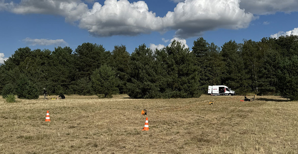
Applied geophysics refers to various exploration techniques that can be used to examine and characterize the near-surface subsurface. These techniques can be used to answer questions from very different disciplines such as archaeology, agriculture, civil engineering, and hydrology. Applied geophysical methods are also important tools in geology and raw material exploration to efficiently investigate the hidden subsurface. Most of these common techniques will be practiced this week. The team started with magnetic measurements on Monday, followed by electromagnetic mapping on Tuesday, and used the georadar on Wednesday. Today, Thursday, they are focusing on geoelectrics and on the georadar again.
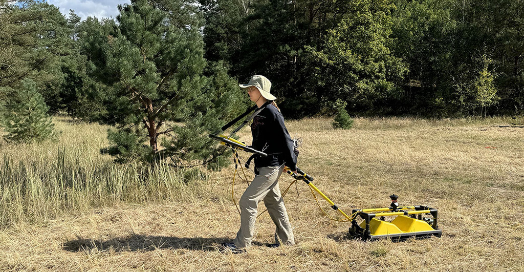
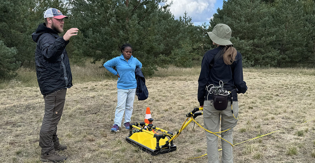
The high-resolution method known as “Ground Penetrating Radar” (GPR) uses high-frequency electromagnetic waves. It can be used to locate structures or objects underground and image them three-dimensionally. Paulina Nitschke straps on the control unit, which is connected to a transmitting and receiving antenna on a skid that is moved along profiles over the area to be investigated. The emitted electromagnetic waves are reflected and refracted at the boundaries of different materials, allowing the system to scan the subsurface over a large area to a depth of several meters.
On the laid-out measuring tapes, the other students mark the endpoints of the profiles with cones, which are moved by a few centimeters after each circuit. Nitschke can see and check the measurements directly on the display. “You have to make sure that you don’t go too fast,” she says. The reason for this is a small colored prism mounted on the GPR skid. "The 360-degree prism is used to record each measuring point in a coordinate system with centimeter-accurate precision,” Diyorbek Toshniyozov explains. It reflects the laser pulses emitted by a surveying instrument, thus recording three-dimensional local coordinates.
Clear indications of human activities
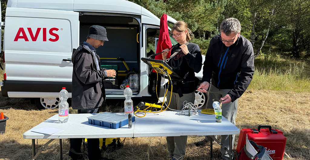
Parallel to the geophysical measurements, Dr. Koyan is taking pictures with a drone for a high-resolution terrain image of the 70-by-70 meter area. “Using so-called control points, which the students record by means of differential GPS, both the terrain image and the local geophysical data can be transferred to a global geoinformation system,” he explains. A computer-aided geographic information system (GIS) consists of hardware, software, and applications that allow the team to collect, manage, model, and analyze spatial data.
An archaeologist from the Brandenburg Lower Monument Protection Authority, who visited the team at the beginning of the week, spoke of a removed hill structure and had historical maps showing the area of the former cemetery. The last burial here took place in 1938 before the property was sold to the municipality in 1944. Nowadays, it is again the property of the Jewish Community of the State of Brandenburg, which, together with the city of Lenzen, the Förderverein Jüdische Geschichte in Potsdam e.V., and the Foundation for Tolerance and International Understanding, wants to make the cemetery visible and commemorate it in a dignified manner.
In the meantime, the Potsdam team has processed and evaluated the measured datasets. All geophysical methods they used show conspicuous patterns that indicate a specific human activity. In particular, the results of the georadar measurements reveal linear and right-angled structures, which are interpreted as clear indications of human activity. “However, based on the results, it is not possible to determine exactly what they represent, and it would be mere speculation without further background information on the construction of the former cemetery,” Tronicke says. “We handed over our report to the Jewish community and the monument authorities in December 2024. Now we’ll see what the future holds.”
Jens Tronicke has been Professor of Applied Geophysics at the University of Potsdam since 2005.
This text (in german language) was published in the university magazine Portal - Eins 2025 „Kinder“.