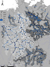
In FloDeMEc the major river basin districts Elbe, Danube, Maas, Oder, Baltic Sea tributaries, Rhine and Weser make up the investigation area. With the help of detailed hydrological units, parts of floodplains are assigned to a gauge along a river. At the gauges runoffs are measured, which are then assigned to floods with a certain probability of occurrence.
For 13 of the 16 federal states floodplain boundaries were compared with the help of flood hazard maps.

