
ABOUT
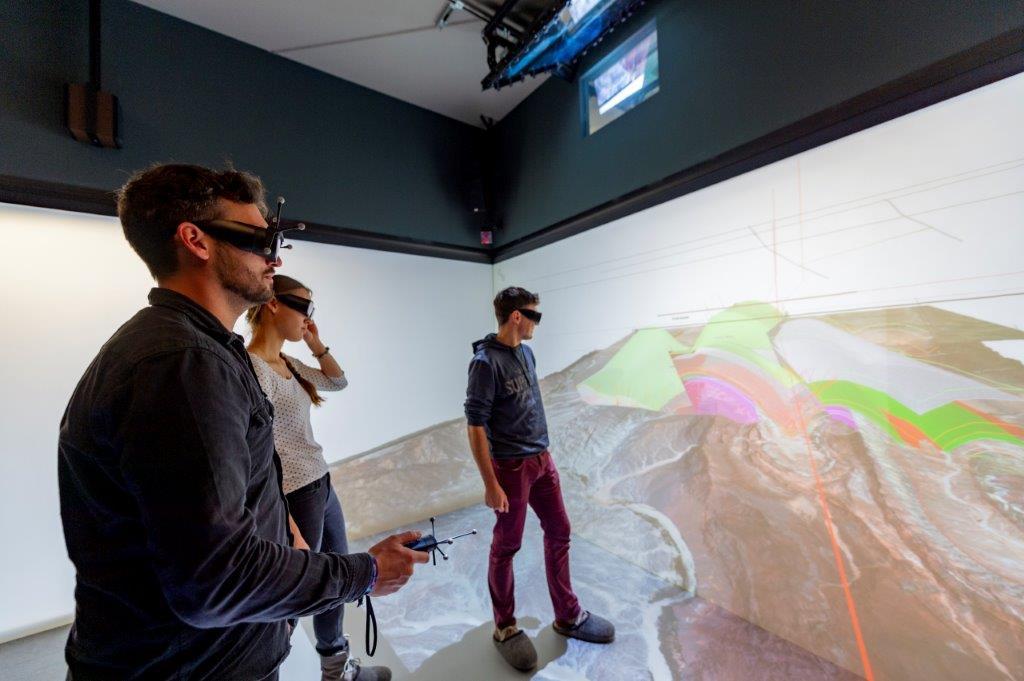
The 3D CAVE is an excellent tool for research and teaching of complex spatial models
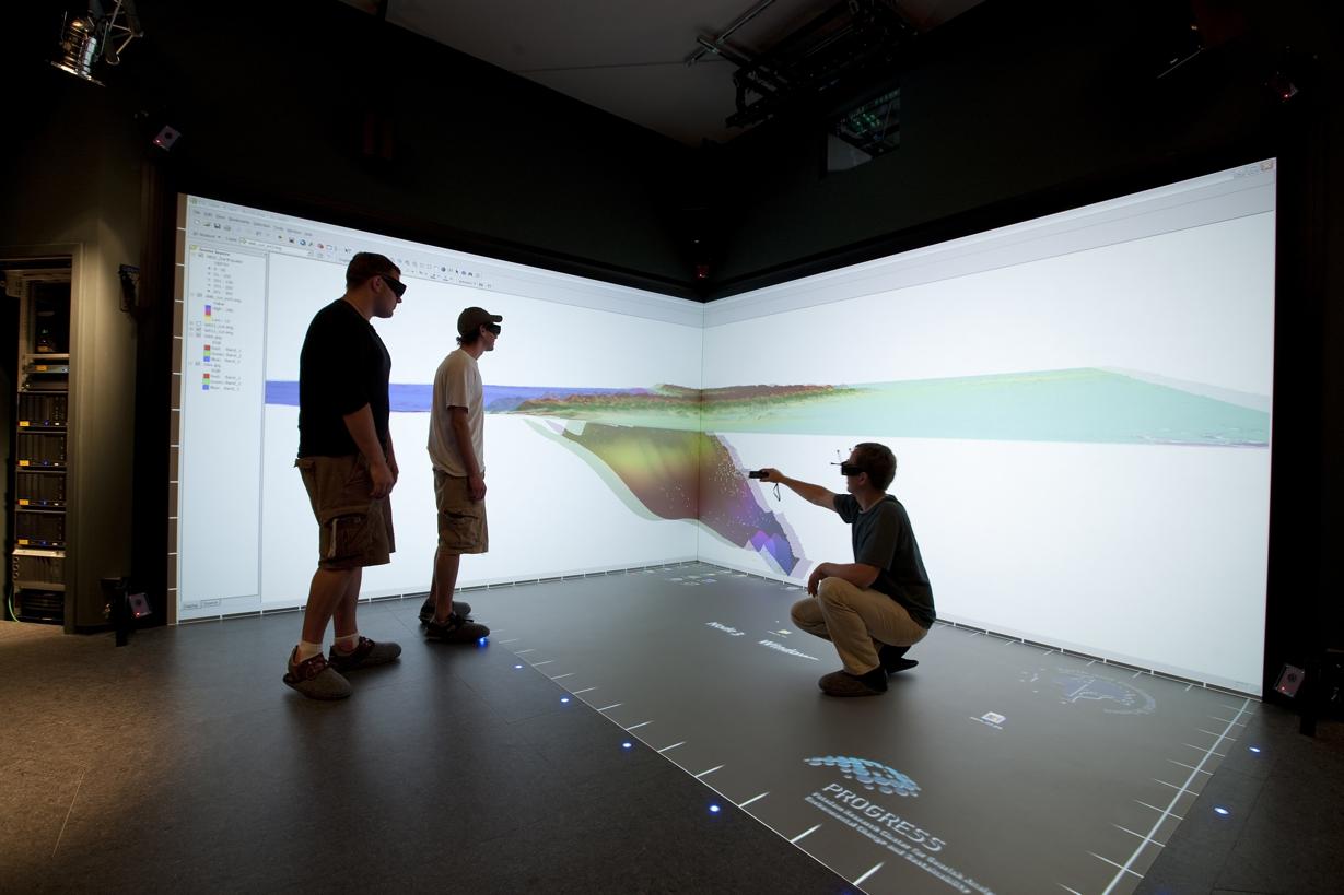
The 3-sided computer animated virtual environment (3D CAVE) at the Institute of Geoscience offers a modern immersive visualization that supports an improved and faster analysis of complex spatial and temporal multi-scale datasets.
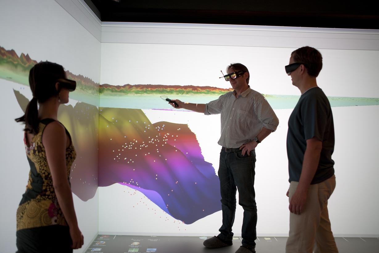
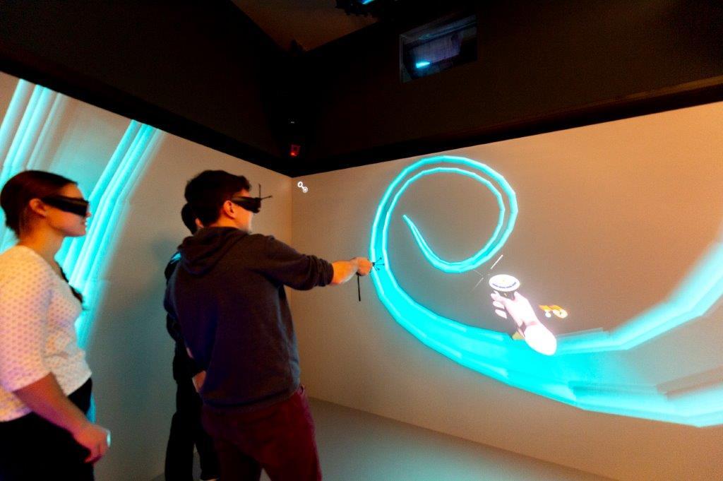
Based on nearly 10 years of experience, we focus on a fast data integration / easy-access usability, building on (1) a fast and smooth data / model transfer from standard software to 3-dimensional visualization, and (2) the immediate possibility of discussing and manipulating models with groups up to 10 users directly within the visualization cluster. The setup offers an inspiring and supportive learning environment, allowing professional interaction with 3D data, presentation and training, as well as knowledge transfer with non-experts.
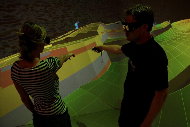
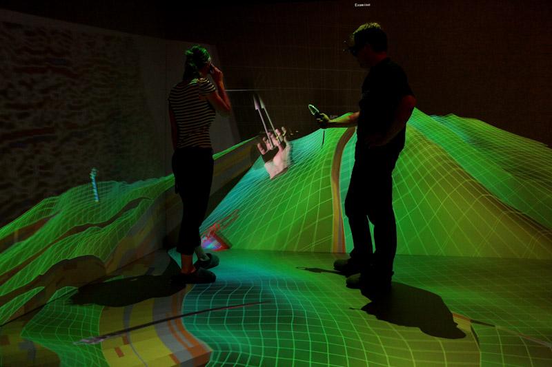
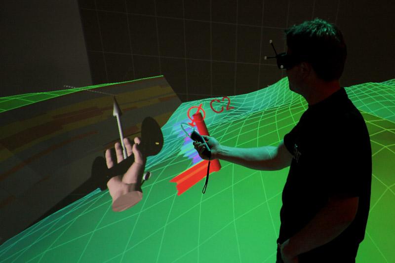
The focus of the lab is to project complex data sets spatially in order to visually analyze data structures and their internal relationships. Simultaneously, sonification and haptification techniques should be used to detect spatiotemporal patterns.
The laboratory comprises a computer cluster and a visualization platform. The computer cluster manages the massive amounts of data, performs calculations and controls the visualization. The visualization platform allows the temporal-spatial representation of the data through special projection technology. Viewers can interact with the projection system and thus grasp the multidimensional relationships. A tracking system with various interactive tools allows this in-situ communication with the data.
In addition to its scientific use, the lab is of central importance for industrial cooperation. Numerous large and medium-sized companies have registered a need to use the lab. In the course of more intensive cooperation, new (third-party funded) projects with industrial participation have been promised. The laboratory is an integral part of the BMBF joint project PROGRESS and is integrated into the pearls and Geo.X research alliances. Financing comes from federal funds.
Based on nearly 10 years of experience, we focus on a fast data integration / easy-access usability, building on (1) a fast and smooth data / model transfer from standard software to 3-dimensional visualization, and (2) the immediate possibility of discussing and manipulating models with groups up to 10 users directly within the visualization cluster. The setup offers an inspiring and supportive learning environment, allowing professional interaction with 3D data, presentation and training, as well as knowledge transfer with non-experts.
The focus of the lab is to project complex data sets spatially in order to visually analyze data structures and their internal relationships. Simultaneously, sonification and haptification techniques should be used to detect spatiotemporal patterns.
The laboratory comprises a computer cluster and a visualization platform. The computer cluster manages the massive amounts of data, performs calculations and controls the visualization. The visualization platform allows the temporal-spatial representation of the data through special projection technology. Viewers can interact with the projection system and thus grasp the multidimensional relationships. A tracking system with various interactive tools allows this in-situ communication with the data.
In addition to its scientific use, the lab is of central importance for industrial cooperation. Numerous large and medium-sized companies have registered a need to use the lab. In the course of more intensive cooperation, new (third-party funded) projects with industrial participation have been promised. The laboratory is an integral part of the BMBF joint project PROGRESS and is integrated into the pearls and Geo.X research alliances. Financing comes from federal funds.
TEAM
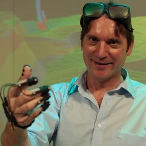
Dr. Gerold Zeilinger
Head and Geological Applications
Since 2005 Researcher at Geosciences in Potsdam. Diploma in Geology in 1997, Tübingen University. Doctor degree 2002 at ETH Zurich, with studies in NW-Himalaya using modern field techniques for plate collision reconstruction. Followed by postdoc positions in Genève, Bern and Zurich with research foci on deformation processes and feedback mechanisms acting between erosion and crustal response. Current projects in geological GIS/3D applications include remote sensing methods for surface change detection and quantification.
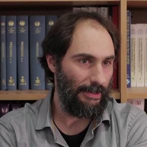
Dr. Matthias Ohrnberger
Geophysical Applications
Since 1997 researcher at Institute of Geosciences of University of Potsdam.
Diploma in Geophysics from LMU Munich, Doctoral degree in Geophysics obtained 2001 at University of Potsdam with research on volcano seismology at the Indonesian high-risk volcano Merapi. Focus of research has been multi-component digital signal processing and the application of intelligent (knowledge driven) data analysis methods to seismological problems. Special interest on seismologically observable dynamic processes from tiniest environmental and anthropogenic signals to megathrust Earthquakes. Current projects are related to real-time impact assessment of mid-sized EQ in the Mediterranean, the long-term observation of earthquake swarms at a 3D-sensor network and the use of large-N sensor networks for the observations of 3D wave propagation phenomena.
Diploma in Geophysics from LMU Munich, Doctoral degree in Geophysics obtained 2001 at University of Potsdam with research on volcano seismology at the Indonesian high-risk volcano Merapi. Focus of research has been multi-component digital signal processing and the application of intelligent (knowledge driven) data analysis methods to seismological problems. Special interest on seismologically observable dynamic processes from tiniest environmental and anthropogenic signals to megathrust Earthquakes. Current projects are related to real-time impact assessment of mid-sized EQ in the Mediterranean, the long-term observation of earthquake swarms at a 3D-sensor network and the use of large-N sensor networks for the observations of 3D wave propagation phenomena.
PROJECTS
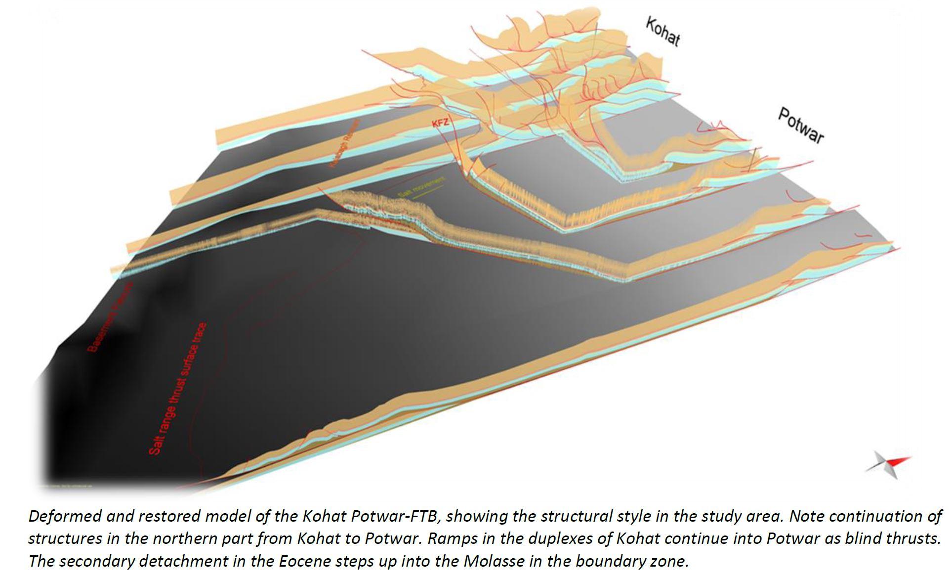
Photo: H. Ghani
Structures in Pakistan
Three-dimensional assessment of tectonic-morphological structures, Case study in Pakistan
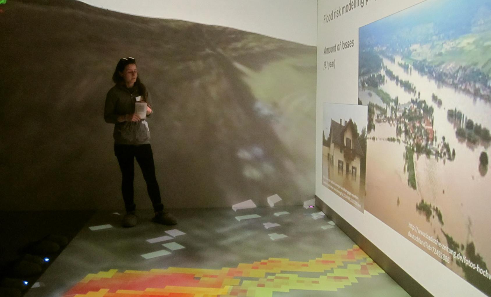
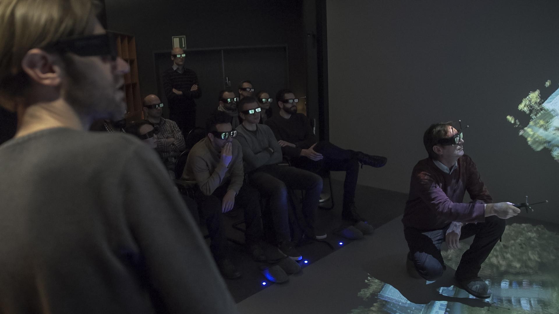

Photo: T. Hopfgarten
Structural Geology Andes
Geological and stratigraphic modeling in Tonco area, Andes
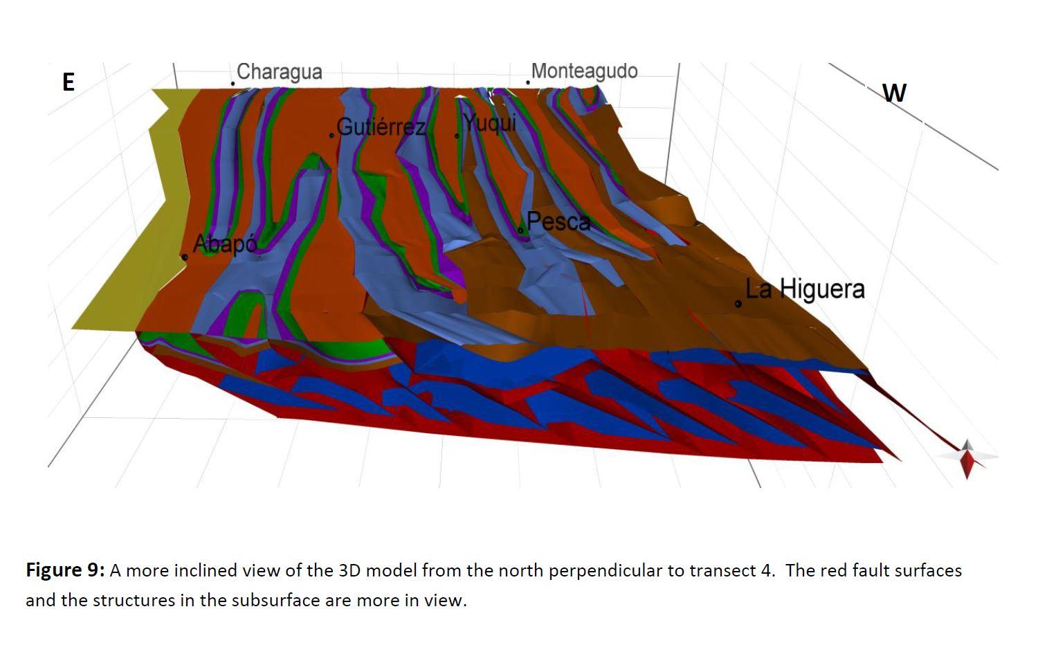
Photo: X. Hadeen
Deformational structures in Bolivia
Three-dimensional model of the Bolivian Subandes and Salar de Uyuni Altiplano structures at different scales
EQUIPMENT
Equipment & Methods
CAVE Software
Sound system
- Three 3.84 x 2.4 m screens (two side walls, one floor), 2 mm pixel resolution
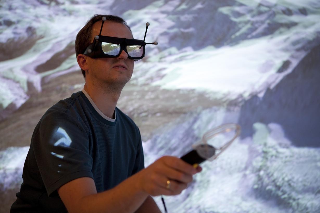
- Active Infitec 3D stereo technology for max. 10 persons
- Modern ART head-, flightstick- and finger-tracking system
- Standard science software: e.g. ArcGIS, Matlab, ParaView, VMD and many more
- Innovative for the analysis of spatial and temporal multi-scale datasets
- Modification of models directly within the CAVE
CAVE Software
- Arc Scene
- Petrel
- Visit
- MOVE
- ParaView
- Fledermaus
- VRML
- Google Earth and Google Sketchup
- ... and more (please contact us for more detailed information)
Sound system
- Denon 7.1 Receiver
- Teufel 7.1 Soundsystem
Technical specifications
Tracking system
Media control
- 3 sided Cave
- 2 screens at a 90 ° angle (rear projection)
- 1 floor projection (front projection)
- each 3.84 m x 2.40 m
- 3 projectors Barco NW - 12
- Resolution 1920x1200px (WUXGA)
- Connection via DVI, RGBHV, VGA
- Control via Ethernet
Stereo projections
- Active Stereo
- Active Infitec
- 1 control unit: 2 x Intel Xeon X5550, 24 GB main memory, NVIDIA M 5000
- 3 nodes: Intel Xeon X5550, 12 GB main memory, NVIDIA Quadro M 5000
Tracking system
- A.R.T.- optical tracking system
- Six cameras
- Input device: Flystick 3, finger tracking
Media control
- Crestron
CONTACT
Want to know more or you are interested in using the CAVE? Contact us by this form.
ADDRESS
Dr. Gerold Zeilinger
Building 27, Room 2.27
University of Potsdam
Institute of Geosciences
Karl-Liebknecht-Str. 24/25
D-14476 Golm
Phone: +49-331-977-5839
Fax: +49-331-977-5700
zeilinger@geo.uni-potsdam.de
Dr. Gerold Zeilinger
Building 27, Room 2.27
University of Potsdam
Institute of Geosciences
Karl-Liebknecht-Str. 24/25
D-14476 Golm
Phone: +49-331-977-5839
Fax: +49-331-977-5700
zeilinger@geo.uni-potsdam.de
send